Last Updated 11/14/02
Survey Chief for Windows
| What's New?
|
|---|
11/14/02 Survey Chief 5.1.0 was released. New features include:
- Additional attributes can be added to cogo points. This allows you to
store a virtually unlimited amount of data with each point.
- Attributes can contain links to other file types, such as digital pictures
or word processing files, and are opened automatically, just by double clicking the attribute.
- Custom printing formats are available for Cogo, Topo, Baseline, Gradeline, and Gradesheet file types.
Format your printouts the way you (or your client) would like to see them.
- New Rotation wizard simplifies rotations and allows you to save commonly used
grid transformations.
- 510: Added the ability to edit multiple text entities in a drawing simultaneously.
- 510: Added support for attrbutes to Topo reduction.
Data from various topo fields can be assigned to user defined attributes.
- 510: Enhanced the expression processing for filters,
allowing you to display only points meeting a specific set of conditions.
- 510: Added the ability to use attribute data in the description writer.
- 510: Added the ability to copy stored transformations in a text format which can be pasted directly
into AutoCAD to simplfy block and XREF insertions and grid transformations.
- 510: Corrected a problem with DXF export of ARCs.
- 510: Corrected some minor issues with Windows XP.
|
Survey Chief 5 for Windows 95/98/ME/NT/2K has now been released.
Survey Chief includes the following features:
-
Provides reliable, error free communication with Party Chief software.
-
Stores all file types used by Party Chief including Cogo, Topo, Baseline, Gradeline, Template, and Gradesheet files.
-
Allows you to print all file types in several formats including entire file, point ranges, or summary.
-
Includes basic Cogo functions (Inverse, Traverse, Stakeout Tie, Sideshot, Offset/Run, etc.) which function
like their counterparts in Party Chief. This makes it easy to quickly check coordinates in the PC.
-
Includes a DMD area routine which allows you to compute areas and generate a complete run sheet.
-
Rotate/Shift/Scale entire files or point ranges and print a report showing exactly what points were rotated and how.
-
Match routine finds the best fitting points between two different grid systems for use in Rotate/Translate.
-
Reduce raw Topo data to a Cogo file, preserving line and symbol coding in the Text field.
-
Reduce Gradesheet data to a Cogo file, for quick visual checking of stakeout work.
-
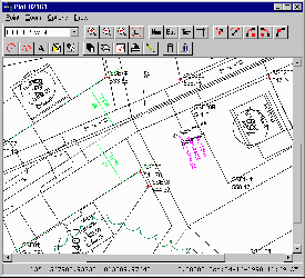
Cogo files can be plotted on screen. This includes line and symbol coding defined in Party Chief Topo collection.
-
Cogo plots can be quickly and easily output to your printer or plotter.
If you just need a quick check plot or small worksheet there is no need to go through a complex CAD program.
Field personnel can generate their own maps and details as needed.
-
Linework created in Topo collection can be exported in a DXF format for use in your CAD software.
-
Description Writer generates a legal description using your own style and wording.

- Each symbol can be mapped to its own block and layer when exporting DXF.
- Import DXF files giving you a graphical base sheet to make your cogo points more understandable.
- Create coordinate points from graphical entities brought in by DXF.
- The ability to copy/cut/paste points simplifies file management and transfers.
- Generic ASCII transfers supporting our SiteStake program, SDR data collectors and many other handhelds that read/write comma delimited ASCII coordinate files.
- A powerful Search & Replace function allowing you to define and save common translations you perform.
- Define multiple import/export formats allowing you to communicate with virtually any software.
- Define filters allowing you to work with sets of points based on coordinates, codes, or attributes.
Survey Chief Version 5.1.0 is the latest version for 95/98/ME/NT/2K/XP.
The latest version may be downloaded from the
trial download page.
This version requires a release code to activate the software once the trial period expires.
System Requirements:
486 or Pentium with 32meg RAM, 800x600 SVGA graphics, Windows 95/98/NT/2K.
1024x768 or better video recommended for drafting/plotting.
FileMan48 Surveyors Database
FileMan48 was a transfer and database program designed to work in conjunction with RAMSS' Party Chief
Surveying Software for the HP48. It was replaced by Survey Chief for DOS, and eventually,
Survey Chief for Windows. It is no longer available for sale, but existing users can upgrade to
Survey Chief.
The current (and final) DOS version of FileMan48 and Survey Chief is 3.3g.
If you have an earlier DOS version see updates
for information on ordering the latest version.
RAMSS Inc. * Surveying & Engineering Software
54 Winters Street * Westminster, MD 21157
800-617-7267 Sales * 410-876-7267 Support * 410-876-7603 Fax
Copyright © 2002 RAMSS Inc. All rights reserved.
Student Cogo, HYDRAtools, HYDROmate, and the RAMSS logo are trademarks of RAMSS Inc.
HP48 is a trademark of Hewlett Packard.
Revision History
02/10/99 Added button bar, revised address, added META
03/01/99 minor revisions per weblint
12/16/99 Updated for 411
08/25/00 Updated for 412, added Desc Meta
01/17/01 updated for 500
08/01/02 SC502, deprecated FM
11/14/02 updated for 510


